
Supporting Woodland LiDAR Surveys with Equipment from PQS Tech
- Dan Shaw
- Mar 4
- 1 min read

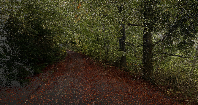
Wren 3D has also worked with the team at PQS Tech when hiring specialist geospatial equipment for woodland LiDAR survey projects. Access to high quality instrumentation and knowledgeable technical support is essential when testing and deploying new mapping technologies in complex environments such as dense woodland, where canopy cover, terrain variation, and occlusion can present significant challenges for spatial data capture.
During recent survey work we hired equipment through PQS Tech and found their team extremely helpful throughout the process, providing both practical guidance and technical insight into the capabilities of emerging mobile mapping technologies. Collaborating with experienced suppliers helps ensure that new tools can be properly evaluated in real world survey conditions and integrated effectively into existing LiDAR and point cloud processing workflows.
PQS Tech have also published a useful overview discussing the use of handheld LiDAR systems for woodland structural mapping, which provides further context on how these technologies are being applied within forestry and environmental surveying. The article can be read here:


Comments